Sophia picked me up in Indy at work on Friday for a weekend adventure in Anza Borrego. We headed up I-15 to Scripps Poway Parkway and its steep hills up and over to S-67. I was expecting traffic on the first portion. But not into Ramona. Yikes. After waiting in traffic from Woodson Mountain, we finally connected with S-78 in Ramona.
After a quick stop to pick up forgotten groceries, we headed up more hills and twisty roads into Santa Ysabel. We didn't stop for Dudley's bread but turned north onto S-79 to avoid the hill up into Julian. At the junction for S-2 we pulled over to put on jackets and switch drivers. And wouldn't you know it, Debbie and Wendy pull in right behind us. Almost as if we'd caravanned (no offense to vans.)
After a short jog on the S-2 to the S-22 in a parade of campers and pickups towing off-road vehicles later we were finally on our last leg into Borrego Springs. But first the truck in front of us lost its trailer going over the cow grates and sent a shower of sparks flying. We had to go down the Montezuma grade after dark. The brakes held out great and in fact we nearly caught up to the speedy SUVs that passed us near the top by the time we got to the bottom.
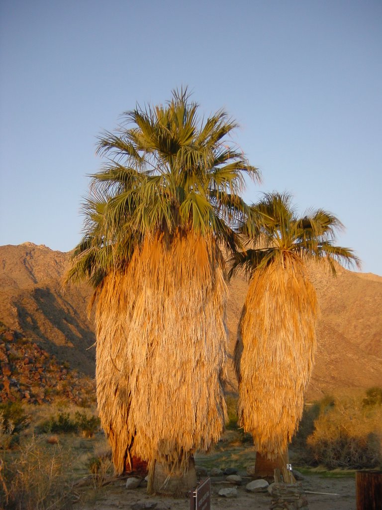
The Borrego Palm Canyon Campground is just at the bottom of the mountains, under Indian Head at the foot of the Palm Canyon. We drove around for a bit looking for the ideal site and ended up choosing #70. The evening weather was spectacular and we had a bonus shooting star display while we ate dinner around a campfire.
Day 2: Camping
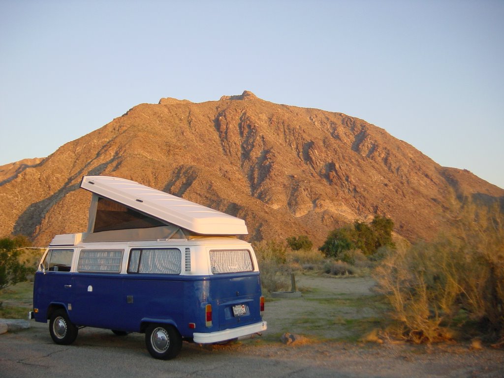
We woke up early (7am) to see the sun rising over Fonts Point. After breakfast, everyone got a tour of the bus as noone had seen the inside of one before. It is kind of difficult to explain how the bed folds down and how one gets upstairs.
The rest of the day was a typical day hanging out at a desert campground. Well, except that Debbie potentially broke her wrist when she fell on the hike up the canyon to see the palms. She wasn't in much pain and so hopefully it is just a sprain. The medical facilities in Borrego Springs didn't have an x-ray machine.
Don and Lorrie made it around sunset. They only stayed until dessert though before driving back. They got lucky too and saw some of the shooting stars.
More perfect weather if not a little too warm. I wish we had an extra tarp that we could have hung up over the covered picnic table for shade. Our stand alone shelter worked though even if we had to play chase to stay in the cool.
Day 3: Getting home the long way
Another sunrise. This time at 6am though because the time changed at midnight.
I wanted Sophia to see the Salton Sea. Rebecca was going to try to go mountain biking. And Debbie (along with Wendy) were off back to the city to check out her wrist. So we all left the campground and went our own direction.
We kept heading East on S-22 past the badlands into Imperial County towards the Salton Sea. Going this way added another county to our map (California:Imperial). The aggriculture area makes it feel like a different country. But the oddest bit are all the off-road vehicles. We saw lots of campers pulling trailers of ATVs and motocycles. And a few trails of dust.
The badlands just before the county border really do intrigue me. I ought to plan a trip with someone in a jeep to explore them. Or perhaps I need to get my mountain bike in riding shape (and moreso myself) and go exploring.
We didn't actually go to the shoreline, nor even get out of the bus at the sea. Instead we just headed south on the divided S-86 to Westmorland, Brawley, and El Centro. We came down the 86 into El Centro. We should have gone to US-111 for the divided highway.
We picked up a fresh tank of gas ($2.85/gal) and hoped to get real Mexican food without much luck. Looking at the map now, perhaps we should have gone into Mexico. We could have picked up perhaps two Mexican states (Sonora and Baja California Norte) if we'd planned a little better. Or at least proper food in Mexicali or Tecate.
Instead, we took the blue road (S-80) from the 3 building town of Seeley through Plaster City (a factory and off-roader camp) to Coyote and Ocotillo, looking for the place the locals would eat. We eventually had a picnic in Ocotillo because we just couldn't find Mexican food.
And then we got onto Interstate 8 to head up above 4000ft again into San Diego county and the 87 miles to Ocean Beach. One very interesting new bit along this stretch was the wind generator farm near Live Oak Springs and the Campo Indian Reservation.
We changed drivers in Lakeside and headed into the city. We would have been heading directly home except we needed a detour up I-15 to my office to pick up my car. We were home and unpacked and the dog bathed by 4pm.
Distances:
To work: 17 miles
To Santa Ysabel: 40 miles
To Borrego Springs: 36 miles
To Salton Sea: 27 miles
To El Centro: 52 miles
To Ocotillo: 27 miles
To home: 90 miles
Total: 289 miles

No comments:
Post a Comment